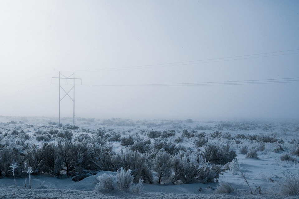
REGINA — Weather in the last month of 2024 for Saskatchewan brought a mixture of freezing rain and snow as well as cold and warm temperatures.
Environment Canada Meteorologist Danielle Desjardins says December started colder than normal before warm Pacific air came through to bring temperatures up. The cold returned in the middle of the month then another push of warmth brought temperatures up for the Christmas holidays and to the end of the year.
“It was quite a bit above normal for the holiday season, so we were seeing temperatures actually above zero for a large portion of Saskatchewan, especially southern and central Saskatchewan, so it was more-or-less a roller-coaster essentially throughout the entire month,” said Desjardins. “We went from one extreme to another kind of week-to-week throughout the month.”
For the entire month of December, every weather station in the province recorded above-average temperatures with Key Lake, La Ronge, Prince Albert, Meadow Lake, North Battleford and Moose Jaw –°¿∂ ”∆µ two degrees or more above their respective averages. Estevan, Saskatoon, Swift Current, and Yorkton were about 1.5 degrees above average, and Regina was the closest to the monthly average by 0.7 degrees; Regina recorded an average temperature of -11.7 degrees compared to its historical average is of -12.4.
“It was almost like we were just in the right spot over the Prairies where we had the warm air come in and the cold air scour that warm air out and then it kind of repeated itself a couple of times throughout the month, which gave these big extremes in temperature really. We were seeing temperatures into the minus 30s and then in a matter of a few days temperatures nearing zero over the province, so very huge temperature swings,” she said.
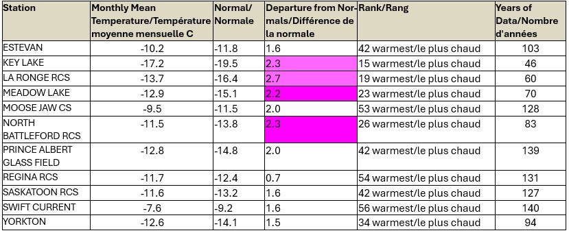
Temperature chart for December 2024, showing each weather station's average temperature | Source: Environment and Climate Change Canada
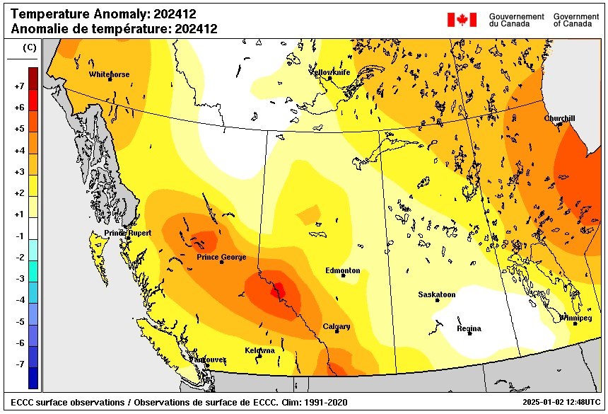
Temperature Graphic of Western Canada during December 2024. | Source: Environment and Climate Change Canada
Precipitation for the month had a combination of rain and snow. Desjardins says areas along the Yellowhead highway and south of it got more than 100 per cent of average precipitation for the month, while areas north of the Yellowhead got less. It was due to two clipper systems that went across southern and central Saskatchewan and when it combined with the warm air, produced rain and freezing rain.
She noted two notable precipitation events that occurred in December. One was on the 5th and 6th when Environment Canada expected upwards of 10 to 15 cm of snow but there was only 5 cm due to some of it turning into rain. The other occurred on the 18th and 19th when areas between the Yellowhead Highway and the TransCanada Highway received between 10 and 20 cm of snow.
Precipitation averages for all the weather stations varied with Prince Albert –°¿∂ ”∆µ the driest at 7 mm, which is 42 per cent of normal. Estevan, Key Lake, North Battleford, Saskatoon and Swift Current recorded above average precipitation. Regina had 13.7 mm, which is 87 per cent of normal.
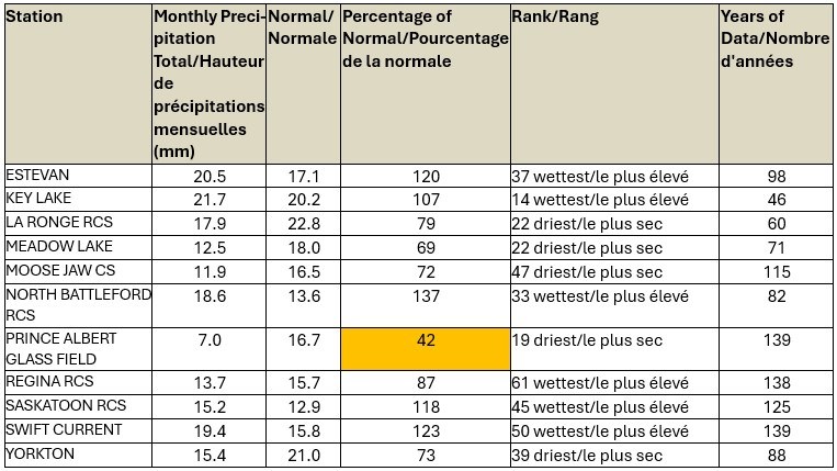
Precipitation Chart for each weather station in Saskatchewan for December 2024. | Source: Environment and Climate Change Canada
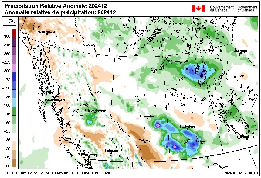
Precipitation Chart for each weather station in Saskatchewan for December 2024. | Source: Environment and Climate Change Canada
